Wednesday, September 19, 2018

RMNP - Above Pear Lake

Todays hike was in the Wild Basin area of RMNP.  There are many lakes in this area.  Most require a 8+ mile hike.  I've been to most of the 'lower' lakes, but I've decided some of the other 'higher' lakes are in order.  These almost always will require a 15+ mile hike.  Today, I decided to see the lakes that are above Pear Lake.  It is about a 6.5 mile hike just to get to Pear Lake.  There are about seven lakes/ponds beyond Pear Lake.  Two have names; Cony and Hutcheson, the rest are unnamed.  There are one or two ponds on the way to Pear Lake.  I found one to be dry, but the other was in good shape.


Dry Pond
Pond #1 - maybe two acres in size
In the early 1900s Pear Lake was dammed in order to supply water for downstream use.  At some point, the dam was removed and the lake restored to its natural state; although it still has a ring around it where vegetation has not yet taken firm hold.

Pear Lake - looking to the north shore

Pear Lake's south shore

I began to climb the east ridgeline of Pear Lake in search of more lakes/ponds.  I soon found a small pond.

Pond #2, maybe an acre in size
As I continued to climb, I came across another small pond.  This one was not on the map.

Pond #3 - very small
According to the map there was a relatively large, unnamed, lake about a half mile away.  As I headed up the hill in the deep forest, I started a fairly steep decline.  This I thought was a good sign that I was coming up on a lake.  Sure enough, I soon turned the corner and found the unnamed lake.  Once in a while, I come across a feature that I just have to stop and say, 'WOW'.  This lake was one of those times.  The pictures don't even begin to do the scene justice.

Unnamed Lake -lunch spot. Looking to the north shore

Unnamed Lake - East shore. 
 The east shore of the lake is nothing but a jumble of boulders that have fallen from the mountain behind them.  When standing there, it looks like the whole side of the mountain fell down all at once.

Unnamed Lake - looking to north sore with St Vrain Mountain in the background
The trail continues up the valley/canyon to Hutchinson and Cony Lakes.  The path looked very doable.

Faint Trail to Hutchenson & Cony Lakes

Up the valley to the next set of lakes
However, I had met both my allotted time and my half-way distance points, so it was time to turn around and head home.  To see the upper lakes, I thinks some day, I will either backpack in and stay at Pear Lake or get to the trailhead very early and plan to come home at dark.

All these lakes sit underneath several 12000'+ and 13000'+ mountains that always just leave me amazed eat the work glaciers can do.

Ogallala Peak

Elk Tooth

Copeland Mountain

Looking up Cony Creek


All in all it was a fun day!


Wednesday, June 27, 2018

RMNP - Spruce Lake

This is the first journal entry in a little over a year.  The last one was June 11, 2017.  It has been a busy year, with not much time for journalling.

Today's hike was to Spruce Lake in RMNP.  The Spruce Lake trail is a spur off the Fern Lake Trail.  While I have been to Fern Lake many times, I have never taken the spur to Spruce.  I started at the Cub Lake TH, hiked to Cub Lake, then over the hill to the Pool, and then joined the Fern Lake Trail there.  The park was very busy today, but that did not lessen the enjoyment of the hike.

There were quite a few wildflowers in bloom on the way to Cub Lake

King's Crown
Indian Paintbrush
Kings Crown

Cub Lake was unusually pretty today.

Cub Lake

After gaining the Fern Lake Trail, the first thing to pay attention to is Fern Falls.  They were flowing well.
Fern Falls

I reached the trail junction to Spruce Lake.  The trail itself is "unimproved", but there is enough traffic to make finding the path easy, although I had to look for some cairns in some of the rockier areas.  This trail gave me a little different view into the Odessa Gorge area where Odessa Lake lies.

Odessa Gorge from Spruce Lake Trail

Spruce Lake must be a fisherman's paradise.  When I reached the lake there were 8-10 folks fly-fishing all around the lake.  The area around the lake is heavily forested, but with some nice views of Gabletop Mountain.
Spruce Lake looking NNE
An unnamed peak WSW of Spruce lake

Gabletop Mountain

All in all is was a good day.


Sunday, June 11, 2017

Drake - Crosier Mountain & Piper Meadow

My last hike was 26 days ago.  Between going on a camping trip and remodeling the laundry, I haven't had time for hiking.  I took timeout from the laundry remodel to tackle Crosier Mountain Trail.

My first trip to the Crosier Mountain Trail was in 2009 or 2010.  I only hike a few miles, but had decided someday to tackle it all.  For most of 2015/6 the road to Glen Haven was under construction and the TH was closed, then in the fall of 2016 the road through the Big Thompson Canyon was closed.  Last week that road opened up for the summer, so I decided today was the day.

The day was just about perfect.  It was cool in the morning then warmed up to the low 70s by early afternoon, with a nice single digit wind; just enough to keep the sweat manageable.  The trail to Crosier Mountain is basically one long five mile climb; steep in most places, but broken up often enough with small flat meadows to not be a complete killer.

Terrain at the trailhead
First big meadow to break the climb
Several times in the climb I was able to catch a glimpse of the North Fork of the Big Thompson Valley and the Big Thompson canyon.

North Fork Valley, looking to Pinnacle Peak in the BT Canyon
 There were a couple of small caves along the way.  I'm betting at some time there were bears here.

Cave along the way
Actually there are still bear in the vicinity; although I didn't see one, I did see a track.


After about two hours of climbing, I reached the spur trail to Crosier Mountain Summit.  The summit is a 600ft vertical climb in a half mile.  I had more to see, so I skipped the summit and continued on.  On the north side of the mountain, the trail descents through thick pine forest to open into a large area known as Piper Meadow.  

My first glimpse of Piper Meadow
The trail makes a large triangle to circumnavigate the meadow.  The views along the meadow and the variety of scenery and history is pretty cool.

Overlooking the meadow and into RMNP

A Cabin ruin

Knapps Knob ; small hill named after Ira Knapp of Glen Haven

Animal skeletons

I finished the loop and began the trek back.  It was a challenging climb back up to Crosier Mountain and an even more challenging steep descent to the truck.  As you can see in some of the pictures, the wildflowers were out in force and I went wild taking pictures of wildflowers.  Here they are.

Not flowers, actually sun on the leaves


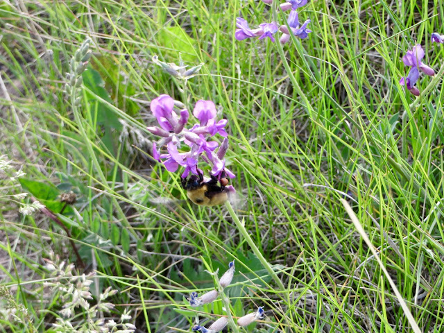
Bumblebees were out too


Overall Track Statistics for Drake - CrosierPiperMdw,   2208 data points

 Length 15.496 miles  :  Garmin Length 16.771 miles
 Start Elevation - 6477.23 feet
 Maximum Elevation - 8719.39 feet
 Minimum Elevation - 6389.67 feet
 Date of Hike - Jun 10, 2017
 Start Time - 07:45 AM
 End Time - 03:56 PM
 Total Duration -     8:11 hours:min
 Total Ascent - 4367.65 feet
 Total Descent - 4455.22 feet
 Net Ascent - -87.57 feet
 Maximum Grade - 23.64%
 Average Speed -  1.89 mph :  Garmin Average Speed  2.05 mph
 Maximum Ascent over Mile - 769.26 feet
 Maximum Speed over Mile -  2.66 mph
 Maximum Gain over Mile (%) - 14.23%


Tuesday, May 16, 2017

Conifer - Staunton State Park

Staunton State Park is Colorado's newest.  I've been wanting to go there for a couple of years.  As usual this year, I didn't want to tackle snow, so I waited till May to try and tackle this one.  I finally determined that the trails were mostly dry, no snow, so this week was the week.  I decided to go on this day because we are scheduled for about a foot of snow in the mountains and foothills in the next couple of days.

The drive to Staunton is not bad, except that you must navigate Denver traffic; always an interesting experience.  I was a bit late getting out of the house, so I didn't get to the trailhead till almost 9:30.  One of the interesting aspects of this hike was that the trail maps were not as accurate as I usually have.  There were many trails that were not on the map or the map had in the wrong position.  There has been alot of work at Staunton, adding trails, routing trails differently, etc.  They are even starting to put in a campground.

I started out on the Mason Creek Trail and was immediately confronted with this sign.

First sign
I thought, 'cool', but alas no bears, no moose today. Sigh...  The Mason Creek Trail follows Mason Creek up the east side of the Elk Creek Valley.  It is a nice flowing stream with plenty of waterfalls and large meadows to enjoy.
Small waterfall on Mason Creek


Many small meadows like this one
The trail eventually moved off Mason Creek and began to climb over the ridge to the next drainage.  The first objective was an old sawmill.  As I moved toward the sawmill, it was easy to see how the area had been logged.

Logged area
It turns out that the sawmill was built in the 20's and operated until the early 60's.

Car parts @ old sawmill

What remains of the mill

The trail moves out of this draining, up and over the ridge.  I took lunch at the top of the ridge.  I had a nice view of the Elk Creek Valley and Pikes Peak in the distance.

Elk Creek Valley
The next destination was Elk Creek Falls lake.  Once at this lake, I would have to decide if I wanted to go on the Elk Creek Falls.  This was a nice, small lake with a small cabin nearby.

Elk Creek Lake
I decided to head for Elk Creek Falls.  One of the new trail additions that was not on the map was a loop trail connecting the Chimney Rock Trail with the Lion's Back Trail.  This would allow me to stop at both Elk Creek Falls and the Elk Creek Falls Overlook without retracing my steps.  The falls are on a spur trail that trail takes a steep descent, but brings you right to the base of the falls.

On this spur trail, I encountered another first.  I've seen ladders and stairs used to help people navigate steep sections of a trail, but this is the first time I've seen and used a chain. I must say, it worked great.

Chain to help descend this short section

I have to say, the climb down and back out was well worth the effort.  These falls were spectacular.  The pictures and video does not do it justice.


The Elk Creek Falls Overlook required another climb and descent to another drainage.  Again, the view was awe-inspiring.

Elk Creek Falls Overlook
Zoomed in
It was time to head home.  As it was, I would be lucky to get back to the truck by four-thirty to be home by 6-ish.  The hike back to the truck required one more steep ridge climb.  I was definitely pooped by the time I got back.

It turns out that by the time I got back to the truck, I had made the longest hike of the year. so far..

Overall Track Statistics for Conifer - Staunton SP,   2200 data points

 Length 16.716 miles  :  Garmin Length 17.672 miles
 Start Elevation - 8330.25 feet
 Maximum Elevation - 9384.48 feet
 Minimum Elevation - 8070.21 feet
 Date of Hike - May 15, 2017
 Start Time - 09:28 AM
 End Time - 04:20 PM
 Total Duration -     6:52 hours:min
 Total Ascent - 3383.43 feet
 Total Descent - 3643.47 feet
 Net Ascent - -260.04 feet
 Maximum Grade - 23.00%
 Average Speed -  2.43 mph :  Garmin Average Speed  2.57 mph
 Maximum Ascent over Mile - 512.40 feet
 Maximum Speed over Mile -  3.16 mph
 Maximum Gain over Mile (%) -  9.07%