There are many trails in Rocky Mountain National Park that I have not been on; Boulder Brook was one of those. So I decided to tackle that one on this hike. This turned out to be more of a conditioning hike than a scenic one. I started the day at Sprague Lake followed the Glacier Creek Trail to where it intersected the Loch Vale Trail, followed the Loch Vale Trail past Alberta Falls, then on to the Longs Peak Trail. Following the Longs Peak trail I met up with the Boulder Brook Trail followed it until the Glacier Creek junction, then back to Sprague Lake.
The trail was characterized by deep forest with limited views. The day was perfect, highs in the low 70s, no clouds, and no wind. I did encounter a trail repair crew which was repairing the Longs Peak trail crossing over Boulder Brook. This are had been destroyed during the September 2013 flood. Here are a few pictures.
 |
| A light dusting of snow on the Mummy's |
 |
| Glacier Creek Crossing on Longs Peak Trail |
 |
| Glacier Creek Crossing on Longs Peak Trail (1) |
 |
| Boulder Brook Trail |
 |
| Trail Crew repairing damage |
 |
| Boulder Brook near Sprague Lake |
 |
| Boulder Brook near Sprague Lake (1) |

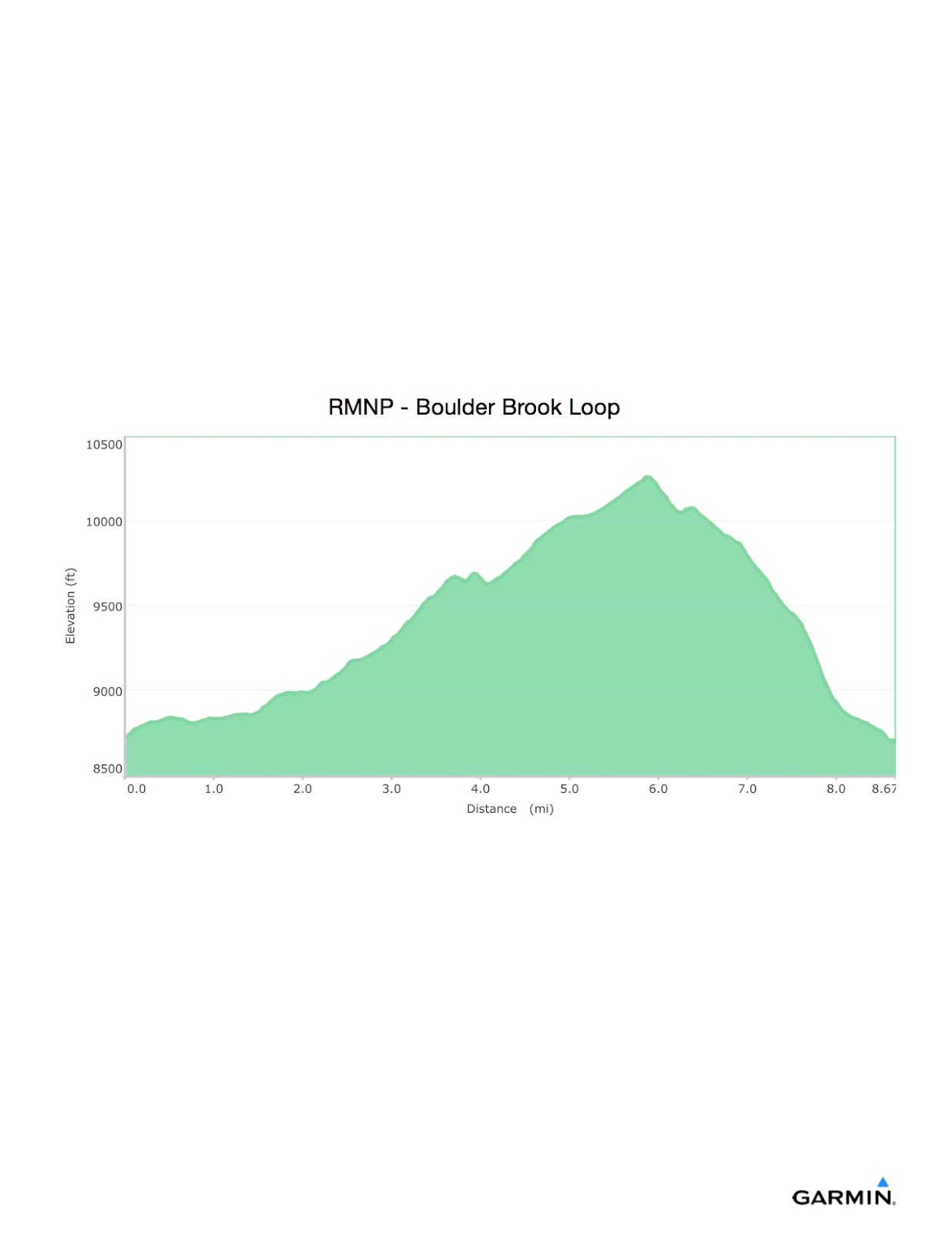
Overall Track Statistics for track RMNP - Boulder Brook Loop
Length 8.665 miles
Start Elevation - 8725.95 feet
Maximum Elevation - 10260.27 feet
Minimum Elevation - 8640.09 feet
Date of Hike - Aug 19, 2015
Start Time - 09:00 AM
End Time - 01:19 PM
Total Duration - 4:18 hours:min
Total Ascent - 1852.76 feet
Total Descent - 1938.62 feet
Net Ascent - -85.86 feet
Maximum Grade - 13.10%
Average Speed - 2.01 mph
Maximum Ascent over Mile - 489.14 feet
Maximum Speed over Mile - 2.97 mph
Maximum Gain over Mile (%) - 9.04%
No comments:
Post a Comment