Showing posts with label Lyons. Show all posts

Monday, March 14, 2016

Hermit Park - Homestead Meadows Trail - north

My friend, Galen, before he passed away had talked about someday our hiking to Homestead Meadows.  He knew I liked to explore old homesteads and ranches.  Unfortunately, he passed away before we could do that.  The primary way into the area was via the Lion Gulch Trail from US36 out of Lyons, but that trail has been closed since the flood of 2013.  Early this winter I discovered that there was a Homestead Meadows Connector Trail from the Hermit Park Open Space.  I decided that as soon as I learned that Hermit Park was open, I would tackle this trail.  Last week, it opened, so here I went.  The winter parking area is about a mile from the trailhead.

Homestead Meadows Connector TH

There are eight homesteads in the area, dating from 1889 to 1923.  They are spread out over a fairly large area, but possibly doable in a long day.  Unfortunately, the weather didn't quite cooperate (snow!) and I only was able to explore the four most northern homesteads.  These pictures don't show much snow, but after I made it to the Brown Homestead, there was plenty on the ground and more coming.  By the time I got back to this parking lot, both my truck and the lot were covered in snow.  Oh well, that will give me a chance to tackle the others in a few weeks when the weather might be better.

No snow at the parking lot, just wait

Irvin Homestead:

The first homestead I visited was the Irvin Homestead and it was the most extensive.  The homestead went through several owners and was generally occupied from 1914 through the mid-1960s.  As a result, the main house and outbuildings are in pretty good shape, therefore there are quite a few pictures.

Irvin Storyboard 
3 stall stable/barn
stalls 
Main Ranchhouse
Main House privy 
Main House bathhouse
According to the sign there is a sunken bathtub here.  Too much snow to check today.
Ranch Office
I'm guessing the above was the ranch office, there was a counter, scales, and stove inside.
Washtubs outside the bunkhouse
 I remember taking a few baths in one of these!  Our indoor shower/tub didn't work too well.
Bunks in the bunkhouse
Bunkhouse privy
So, this is a three-hole privy, two on this side and one on the other.  Not sure why you would need three spots.

Griffith Homestead:

The next homestead on the list was the Griffith Homestead.  It was settled in 1923 and, as far as I can tell was abandoned around 1936.  This homestead had some tragedy.  The homesteader, William Walker, was mending some fence when he returned to the cabin complaining of being short of breath and dizzy.  He took some soda, went back out and was never seen alive again.  They found him about 3/4 of a mile away where he apparently died of a heart attack.

Griffith Storyboard
Main Ranch house
I'm guessing this is what is left of the barn
View of Elk Park from Griffith Homestead

Walker Homestead:

The story of this homestead is one of a self-sufficient and capable women, Sarah Walker.  She left England with her husband and two children.  Somewhere in the story, her husband and children died.  She arrived in Lyons in 1908 and settled her homestead in 1914.  Here she lived for 15 years, alone, until she moved back to Lyons about 1929.

Walker storyboard
I believe this is a bed frame 
Remains of the house (very small house).
There is probably not 150 square feet covered by the stone foundation.  Not much to live in for 15 years.

Brown Homestead:

There was no story board here, so I learned the story of this homestead from a story on the Denver Channel 7 website.  Harry Brown raised cattle and sold timber here starting in 1918.  Sometime later he married and build a house along US36 where he and his wife raised their family.

No Storyboard here.  Main Ranch House
View of house and incoming snow storm
What would have been the view off the front porch
Snow coming in quick
This hike was different than any of my other ones.  I called this a hiking tour.  All my other hikes were either destination, mileage, or time hikes.  It was a lot of fun.  I look forward to tackling the other four southern homesteads and the additional seven or eight miles in the next few weeks.  Here are few other pictures.

There were plenty of tracks of both wild and domestic animals
Typical terrain.  I bet it is beautiful in spring.

Overall Track Statistics for HermitPark - HomesteadNorth,   1503 data points

 Length 10.523 miles  :  Garmin Length 11.008 miles
 Start Elevation - 8417.98 feet
 Maximum Elevation - 8697.90 feet
 Minimum Elevation - 8187.57 feet
 Date of Hike - Mar 14, 2016
 Start Time - 08:56 AM
 End Time - 01:52 PM
 Total Duration -     4:56 hours:min
 Total Ascent - 2267.39 feet
 Total Descent - 2292.55 feet
 Net Ascent - -25.16 feet
 Maximum Grade - 15.80%
 Average Speed -  2.13 mph :  Garmin Average Speed  2.22 mph
 Maximum Ascent over Mile - 432.61 feet
 Maximum Speed over Mile -  3.28 mph
 Maximum Gain over Mile (%) -  5.64%


Friday, November 06, 2015

Lyons - Hall Ranch (Bitterbrush trail)

So a few days ago another colleague texted and wanted to have breakfast.  I said, 'of course' and planned for a 7a breakfast at the Egg & I in Longmont.  Yesterday, another colleague from Folsom, CA was in town and wanted to have lunch at 12p.  I said, 'of course' and planned a noon lunch at the Rib House in Longmont.  That didn't leave much time for hiking, so I planned on a quick hike at Hall Ranch near Lyons.

I've been to Hall Ranch last November and hiked the Bitterbrush/Nighthawk loop.  Since time limited, today I hiked only Bitterbrush and then on the clock!  I got to the trailhead and determined that I could hike for exactly 2h 20m.  That would leave just enough time to get back to the Rib House by noon.  So I set my timer for 1h 10m and headed off.

Much like Heil Valley, Hall Ranch is frequented by mountain bikers and trail runners.  Today, I encountered about the same number of bikers as runners.  I still think both of these types of people are nuts!  There isn't a lot to see at Hall Ranch, but here a a couple of pictures and the usual hike summary information.

Hall Ranch (1)

Coffintop Mountain from Hall Ranch

Antelope Park at Hall Ranch
All in all a quick hike, but one which was still fun.  Oh, by the way, I got to the Rib House right on time.


Track & Map
Overall Track Statistics for track HallRanch-bitterbrush
 Length 7.009 miles
 Start Elevation - 5483.56 feet
 Maximum Elevation - 6350.33 feet
 Minimum Elevation - 5470.24 feet
 Date of Hike - Nov 06, 2015
 Start Time - 09:05 AM
 End Time - 11:23 AM
 Total Duration -     2:17 hours:min
 Total Ascent - 1298.10 feet
 Total Descent - 1311.42 feet
 Net Ascent - -13.32 feet
 Maximum Grade - 13.40%
 Average Speed -  3.07 mph
 Maximum Ascent over Mile - 491.90 feet
 Maximum Speed over Mile -  3.51 mph
 Maximum Gain over Mile (%) -  9.01%


Elevation Profile

Thursday, November 05, 2015

Lyons - Picture Rock / Wild Turkey Loop

It was my usual day to hike, but earlier I had received a text from an old colleague who wanted to have a late breakfast and a catch-up chat.  So I met him in Longmont at Leenie's for breakfast at 9a.  That caused me to adjust my hike for the day to somewhere a bit closer than usual.  We were also scheduled to get some weather early in the afternoon; so those two conditions caused me to choose to hike the Picture Rock Trail at Heil Valley Natural Area outside of Lyons.

Picture Rock TH
The Picture Rock Trail starts just outside of Lyons and meanders up the valley between two hogbacks to the top of the western most hogback before hitting the mountains fully.  The trail is a gentle climb of 5.2 miles to the junction with the Wild Turkey loop.  This trail is frequented heavily by mountain bikers.  In fact, during the day I encountered probably a dozen bikers, but only one hiker and one trail runner.
Heil Valley Natural Area (1)

Heil Valley Natural Area (2)
About a third of the way there is a picnic table that must have been used by the Flintstones, since it is made entirely of rock.
Flintstones Picnic Table
Not too much beyond the Flintstones picnic table, I encountered a small flock of wild turkeys.  They were in the same place on the way down too.
Wild Turkeys (1)

Wild Turkeys (2)
Further up (about half way), there is a homestead that at one time must have been a small ranch.  There is an old flagstone quarry near there too.  This area was very pretty and had a lot of opportunities for pictures.  Silos, the valley, building ruins, a quarry, a hay rake, and a couple of old cars hulks.  I would guess the cars would have been vintage for the 1920's.
Building Ruins
I soon reached the junction with the Wild Turkey Loop.  This would be an added 2.9 miles which I thought I could get through and still make it back home when I said I would.  I had been on the Wild Turkey loop before, so knew what to expect.  I worked my way around the ridge to the Overlook, then down the loop back to Picture Rock trail.  Yep, the weather was starting to move in.
Wild Turkey Overlook
While on my way back to the Picture Rock junction, I found a little wildlife.
Deer
Fox
Once I made the junction, it was all downhill from there.  Eventually the weather did show up and I got rained on for about the last two miles.  Oh well, my rain jacket kept me dry.

Another good hike in the books.


Overall Track Statistics for track Lyons - PictureRock
 Length 14.066 miles
 Start Elevation - 5383.99 feet
 Maximum Elevation - 6592.72 feet
 Minimum Elevation - 5373.72 feet
 Date of Hike - Nov 04, 2015
 Start Time - 10:35 AM
 End Time - 03:52 PM
 Total Duration -     5:17 hours:min
 Total Ascent - 1713.68 feet
 Total Descent - 1714.24 feet
 Net Ascent - -0.56 feet
 Maximum Grade -  6.63%
 Average Speed -  2.66 mph
 Maximum Ascent over Mile - 266.27 feet
 Maximum Speed over Mile -  3.21 mph
 Maximum Gain over Mile (%) -  4.54%


Saturday, October 24, 2015

Lyons - Sleepy Lion

Wow, it has been five and a half weeks since my last hike to Finch/Pear Lake.  Time sure flies when getting ready for a trip to New England and the trip itself.  Also, five and a half weeks with no hike, few runs, and most of the time below an elevation of 1000 feet gets one out of shape fast!

This was a 'getting back at it' hike after returning from our trip.  The Button Rock Preserve had been closed since the September 2013 floods.  It had recently reopened and so I thought I would head out to see what there was to see.

There are two main trails in the preserve; the North Shore Trail which works its way around Ralph Price reservoir and the Sleepy Lion trail which loops around to meet up with the Button Rock trail out of Hall Ranch.  Supposedly the Sleepy Lion trail was so named because a ranger saw a sleeping mountain lion along the trail.  Hmm,  the usual Colorado warning; bears, mountain lions, and rattlesnakes.

Access road & Longmont 'reservoir'
Longs Peak & Mount Meeker from Sleepy Lion


It had rained the previous two days so the forest was wet and there were many low lying clouds which made for neat pictures.

Fog & Sun!!

Meadow in the morning

Foggy Bottom


The trail climbed up to a small meadow which allowed for a nice respite, then continued to climb to the junction with the Hall Ranch Button Rock Trail.

Meadow
Junction with Hall Ranch's Button Rock Trail

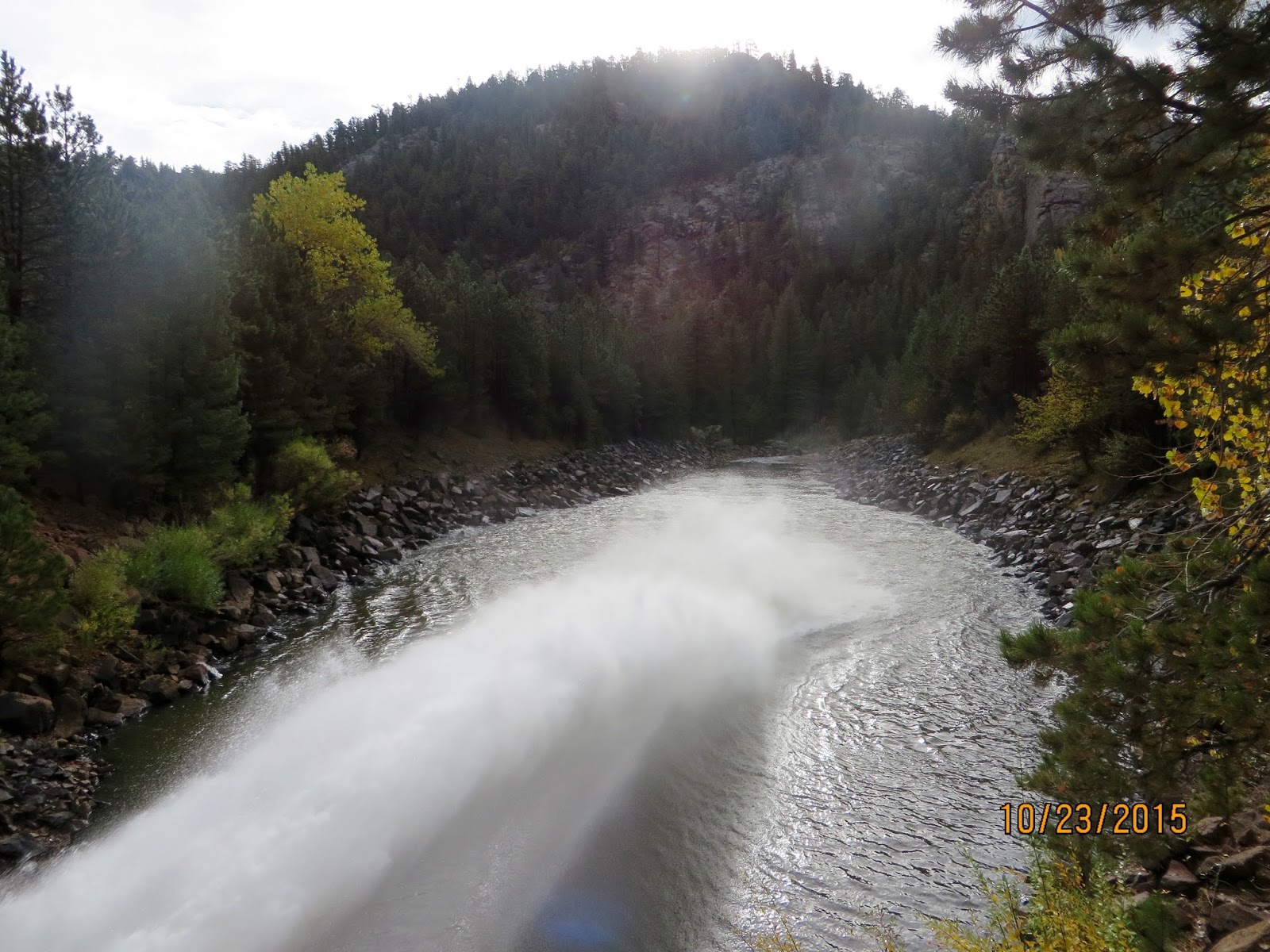
Then down, down, down to the Ralph Price Reservoir.  Ralph Price holds back drinking water for the city of Longmont.  Quite an impressive dam way up here.  As you can see the outlet was running hard.  There is a lot of pressure with 200 ft of water on top.

Ralph Price Reservoir
Ralph Price outlet from a distance


Ralph Price outlet up close

Once past the dam I got back on the access road and headed to the truck and home.  A good hike after a long pause in the schedule.  I may come back another day and hike the north shore trail.

North St Vrain


Overall Track Statistics for track Lyons - BtnRock

 Length 5.148 miles

 Start Elevation - 5934.58 feet
 Maximum Elevation - 6602.43 feet
 Minimum Elevation - 5931.69 feet
 Date of Hike - Oct 23, 2015
 Start Time - 08:03 AM
 End Time - 10:15 AM
 Total Duration -     2:12 hours:min
 Total Ascent - 1159.55 feet
 Total Descent - 957.12 feet
 Net Ascent - 202.43 feet
 Maximum Grade - 15.50%
 Average Speed -  2.34 mph
 Maximum Ascent over Mile - 557.81 feet
 Maximum Speed over Mile -  3.11 mph
 Maximum Gain over Mile (%) -  8.36%