This was a 'getting back at it' hike after returning from our trip. The Button Rock Preserve had been closed since the September 2013 floods. It had recently reopened and so I thought I would head out to see what there was to see.
There are two main trails in the preserve; the North Shore Trail which works its way around Ralph Price reservoir and the Sleepy Lion trail which loops around to meet up with the Button Rock trail out of Hall Ranch. Supposedly the Sleepy Lion trail was so named because a ranger saw a sleeping mountain lion along the trail. Hmm, the usual Colorado warning; bears, mountain lions, and rattlesnakes.
 |
| Access road & Longmont 'reservoir' |
 |
| Longs Peak & Mount Meeker from Sleepy Lion |
It had rained the previous two days so the forest was wet and there were many low lying clouds which made for neat pictures.
 |
| Fog & Sun!! |
 |
| Meadow in the morning |
 |
| Foggy Bottom |
The trail climbed up to a small meadow which allowed for a nice respite, then continued to climb to the junction with the Hall Ranch Button Rock Trail.
 |
| Meadow |
 |
| Junction with Hall Ranch's Button Rock Trail |
Then down, down, down to the Ralph Price Reservoir. Ralph Price holds back drinking water for the city of Longmont. Quite an impressive dam way up here. As you can see the outlet was running hard. There is a lot of pressure with 200 ft of water on top.
 |
| Ralph Price Reservoir |
 |
| Ralph Price outlet from a distance |
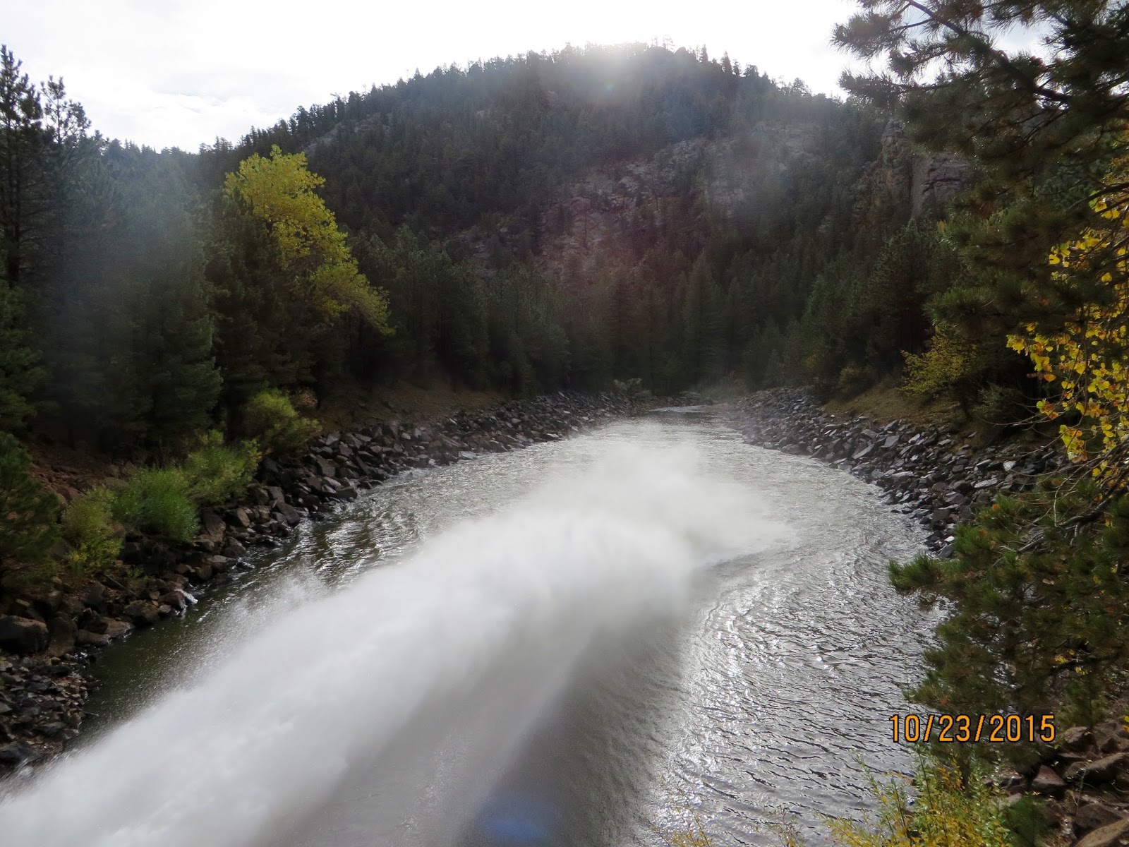 |
| Ralph Price outlet up close |
Once past the dam I got back on the access road and headed to the truck and home. A good hike after a long pause in the schedule. I may come back another day and hike the north shore trail.
 |
| North St Vrain |

Overall Track Statistics for track Lyons - BtnRock
Length 5.148 miles
Start Elevation - 5934.58 feet
Maximum Elevation - 6602.43 feet
Minimum Elevation - 5931.69 feet
Date of Hike - Oct 23, 2015
Start Time - 08:03 AM
End Time - 10:15 AM
Total Duration - 2:12 hours:min
Total Ascent - 1159.55 feet
Total Descent - 957.12 feet
Net Ascent - 202.43 feet
Maximum Grade - 15.50%
Average Speed - 2.34 mph
Maximum Ascent over Mile - 557.81 feet
Maximum Speed over Mile - 3.11 mph
Maximum Gain over Mile (%) - 8.36%

No comments:
Post a Comment