 |
| Smooth trail amongst the Aspen |
I was still early in the season, but we were starting to see some of the Aspens change color. It will be interesting to see how this compares to the tree color in Vermont.
 |
| Early Fall Colors (1) |
 |
| Early Fall Colors (2) |
 |
| St Vrain Mountain |
Then began a long steady climb to Finch Lake. Once I had achieved Finch Lake, I took a brief respite (out of the wind) and reflected in the water. The wind was chopping up the water, but it was still beautiful.
 |
| Finch Lake (1) |
 |
| Finch Lake (2) |
According to the map I would head down for a bit and then a long steady, steep climb to Pear Lake. I don't have a lot to say about the view from the trail as I was focused on getting one foot in front of the other. I did capture a couple of pictures.
 |
| Dry Pond near Pear Lake |
 |
| Foot Bridge |
I reached Pear Lake and was blown away; both figuratively and actually. The wind must have been blowing thirty or forty miles an hour up there. A couple of times I had to steady myself and the camera on a rock to get a decent picture. The peaks around Pear Lake are quite spectacular. I will let the pictures speak for themselves.
 |
| Copeland Mountan (13176') |
 |
| Ogalalla Peak (13138') |
 |
| Copland Mountain (13176') |
 |
| Peaks of Wild Basin (RMNP) |
As you know, I'm not one to retrace my steps if I don't have to, so I decided to make this a loop hike and not just a out/back. The trail down to Calypso Cascades was steep and winding. I encountered quite a little obstacle where the footbridge and part of the side of the hill had been washed away. I took my time, watched my step and got across.
 |
| Washout!!! |
The rest of the hike was beautiful and uneventful. Just like I like them.
 |
| Cony Creek |
 |
| Still some Wildflowers |
 |
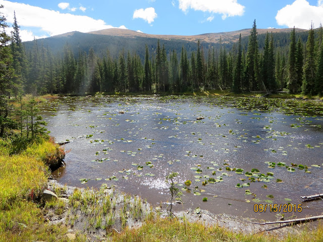
| Unnamed Pond near Pear Lake |
 |
| Track |
Overall Track Statistics for track RMNP - Pear Lake
Length 13.608 miles
Start Elevation - 8640.68 feet
Maximum Elevation - 10572.74 feet
Minimum Elevation - 8091.67 feet
Date of Hike - Sep 15, 2015
Start Time - 08:37 AM
End Time - 02:52 PM
Total Duration - 6:15 hours:min
Total Ascent - 3222.54 feet
Total Descent - 3771.56 feet
Net Ascent - -549.02 feet
Maximum Grade - 18.54%
Average Speed - 2.18 mph
Maximum Ascent over Mile - 648.33 feet
Maximum Speed over Mile - 2.95 mph
Maximum Gain over Mile (%) - 11.85%
 |
| Profile |
No comments:
Post a Comment