Showing posts with label Wild Basin. Show all posts

Thursday, November 17, 2016

RMNP - Lion Lakes & Snowbank Lake

It has been awhile since I posted a journal entry.  It has been a busy late summer, early fall.  I've always wanted to hike to many of the lakes in the Wild Basin area of RMNP, but they have all seemed very long.  Now that I have a bit more stamina, I decided to tackle Lion Lakes.  The hike to Lion Lake follows the same general track as many of the lake hikes in Wild Basin do; follow the trail to Calypso Cascade, then on to Ouzel Falls then on to the junction with Ouzel Lake.  Once there you begin the hike along Thunder Lake Trail to the junction with the Lion Lake Trail.  Up to this point the hike is a long, steady, and moderate climb through dense forest, with some periodic views of the surrounding landscape.   You can begin to tell that Fall is in full swing.  The aspens were out in force.

Long distance line of aspens

A small aspen grove.  Stunning

Once at the Lion Lake Trail junction, the trail climbs steeply then begins a moderate up/down for several miles before reaching Lion Lake #1. You can tell that this area was glaciated at some time, there are some huge rocks just sitting in the middle of the meadows.

Glacier remains?
 Even though it was a nice day, there was still a little ice around.

Ice on the puddles

It seemed to take forever, but I came up out of the trees and there was Lion Lake #1.


Pop out on a nice  meadow, then down through some trees and then Lion Lake #1.

Lion Lake #1 (from the inlet)
Once at Lion Lake #1, I followed the steep trail alongside the creek to Lion Lake #2.  Once there, I could not resist that final attempt at Snowbank Lake.  While all these lakes are incredible, Snowbank Lake takes the prize.

Lion Lake #2, Snowbank is just above

Couldn't resist the reflection of the clouds and the one red wildflower

A snowbank at Snowbank Lake

Snowbank Lake and the west ridge of Chief's Head Mountain

Snowbank Lake and the Continental Divide

Overall this was a uneventful hike that was well worth the effort.  One interesting thing did happen that has never happened before.  On the way back down from Snowbank Lake, while sitting eating my lunch at the inlet to Lion Lake #1, I saw a hiker come out from the trail near the outlet of the lake.  At that point the hiker stopped, put down their pack and started walking about like they were looking for something.  Then they stopped, looked back at the lake squatted down, looked at the lake again, then squatted down for a long time.  Now I sure you know what I was thinking at that point, but soon the hiker jumped up, ran to a rock in front of the lake and did a handstand!  It wasn't a very good handstand, so they then walked back to, what I now knew was a camera, squatted, then ran back and did a perfect handstand.  They then walked back to the camera, picked everything up and head back down the mountain.  There is a first time for everything.

Here are a few other pictures of landscapes I found interesting.

Mt Alice (13310')

Waterfall between Snowbank and Lion #2

Small escarpment to climb

Overall Track Statistics for RMNP - Lion Lake,   1997 data points

 Length 14.839 miles  :  Garmin Length 16.044 miles
 Start Elevation - 8535.93 feet
 Maximum Elevation - 11552.56 feet
 Minimum Elevation - 8363.19 feet
 Date of Hike - Sep 16, 2016
 Start Time - 07:53 AM
 End Time - 03:28 PM
 Total Duration -     7:34 hours:min
 Total Ascent - 3830.02 feet
 Total Descent - 3876.61 feet
 Net Ascent - -46.59 feet
 Maximum Grade - 23.92%
 Average Speed -  1.96 mph :  Garmin Average Speed  2.12 mph
 Maximum Ascent over Mile - 701.31 feet
 Maximum Speed over Mile -  3.17 mph
 Maximum Gain over Mile (%) - 12.72%


Sunday, September 18, 2016

RMNP - Thunder Lake

I had always looked at a map of the Wild Basin area of RMNP and thought, "wow, wouldn't it be cool to hike to all those lakes.  But the hikes are so long, I'll never to that".  Well, today was the day to tackle Thunder Lake.  It seems that RMNP is getting busier and busier each time I go.  Today, even though I was at the Wild Basin entrance a bit before 8, I guessed that the Wild Basin Trailhead parking would be nearly full.  So, I decided to park at the Sandbeach Lake TH instead.  This would add about 4 miles to the trip and I hoped I would not regret that.

The trail from Sandbeach Lake TH to the Wild Basin TH meanders along the road, so it is not a difficult hike, just takes time.  Along the way there is a small lake, Copeland Lake, that some consider a good spot for kid fishing.  It was pretty low today.  There was also some new blowdowns along the way.

The hike from the Wild Basin TH to the 'Camp Cutoff' was busy.  Not as busy as the trails around Glacier Gorge, but much busier than I am used to.  Copeland Falls, Calypso Cascades, and Ouzel Falls are great spots to visit and the trail is kid worthy.  I understand there is also some good fishing along St Vrain creek.

North Fork of North St Vrain Creek

North Fork North St Vrain Creek just before Thunder Lake

North St Vrain Creek

The 'Camp Cutoff' is a direct route to the Thunder Lake trail that bypasses the Calypso Cascades and Ouzel Falls.  There are several backcountry campsites along the route.  It is slightly shorter, but is much more rocky and a bit steeper than the main route.

Once I exited the 'Camp Cutoff' I was on the Thunder Lake Trail.  This trail grinds slowly up the mountain.  It is characterized by long moderate uphill treks followed by short level spots where you can catch your breath.  It is almost completely in dense forest with no views.  Just a few miles before Thunder Lake the trail steepens and you begin a series of long switchbacks which climb the mountain.  At the end of the switchbacks you are rewarded with a beautiful meadow way up high.  Another half mile or so and you get to descend to Thunder Lake.

Meadow, looking NE

Meadow, looking NNE

Meadow, looking west

Thunder Lake is in a cirque bounded by Tanima Peak (12400')

Unnamed Peak just north of Tanima Peak
and Pilot Peak (12113').  There is one more lake above Thunder (Lake of Many Winds) but the hike is pretty steep and I decided to save it for another time.

Looking toward the Boulder/Grand Pass

I believe Thunder Lake is one of the more beautiful lakes in RMNP.  From the look of the surrounding area and the slope of the lakeshore, I would guess it is relatively deep.

Thunder Lake, looking NW

Thunder Lake, looking SSE and down the mountain

Inlet stream falls
There is a patrol cabin up here, as well as, a backcountry campsite.
 
Thunder Lake Patrol Cabin
Llama tied up at the hitchrack

Once I was done exploring the area a bit, I sat down, ate my lunch, took a nap and headed back down.

This was one of the more difficult, but rewarding hikes of the year.

Overall Track Statistics for RMNP - Thunder Lake,   2120 data points

 Length 17.720 miles  :  Garmin Length 19.242 miles
 Start Elevation - 8490.62 feet
 Maximum Elevation - 10665.06 feet
 Minimum Elevation - 8221.62 feet
 Date of Hike - Aug 01, 2016
 Start Time - 07:57 AM
 End Time - 03:21 PM
 Total Duration -     7:23 hours:min
 Total Ascent - 3166.24 feet
 Total Descent - 3435.24 feet
 Net Ascent - -269.00 feet
 Maximum Grade - 15.55%
 Average Speed -  2.40 mph :  Garmin Average Speed  2.60 mph
 Maximum Ascent over Mile - 547.57 feet
 Maximum Speed over Mile -  3.23 mph
 Maximum Gain over Mile (%) - 10.07%


Sunday, September 11, 2016

RMNP - Ouzel Lake

I've wanted to go to Ouzel Lake for quite some time.  Part of the reason is that it is supposed to be a nice hike, but also to give me a reason to know what an Ouzel is.  An Ouzel is a bird, similar to a blackbird, that catches its dinner in fast flowing rivers and streams.  I believe it is also called an American Dipper.  There must be quite a few in the area since there are alot of things called Ouzel <something>

In order to make this a bit longer hike, I chose to start from the Sandbeach Lake TH as opposed to the Wild Basin TH in RMNP.  This would give me about four more miles.  The trail is well marked and well travelled.  This is one of the more popular trails in the Wild Basin area and shares the path with the Ouzel Falls trail, which is possibly the most popular trail in Wild Basin.   You can camp up here and they even have a privy!  I think I would like to spend a night or two up here exploring and fishing.

There really isn't alot to say about the trail other than there was alot of up and down along the way (just look at the elevation profile)  with many people and many different photo opportunities.  Look and, I hope, enjoy.

Ouzel Lake (1)

Ouzel Lake (2)

Ouzel Creek

Looking toward Thunder Lake area

Blowdowns throughout the hike

Ouzel Falls

Ouzel Peak & Ouzel Lake

Privy

Rockface

Subalpine Forest
Snowshoe Hare

More and More Wildflowers


Overall Track Statistics for RMNP - Ouzel Lake,   1972 data points

 Length 15.901 miles  :  Garmin Length 17.100 miles
 Start Elevation - 8344.03 feet
 Maximum Elevation - 10010.60 feet
 Minimum Elevation - 8247.54 feet
 Date of Hike - Jul 21, 2016
 Start Time - 08:22 AM
 End Time - 03:17 PM
 Total Duration -     6:55 hours:min
 Total Ascent - 2944.29 feet
 Total Descent - 3040.78 feet
 Net Ascent - -96.49 feet
 Maximum Grade - 17.40%
 Average Speed -  2.30 mph :  Garmin Average Speed  2.47 mph
 Maximum Ascent over Mile - 601.35 feet
 Maximum Speed over Mile -  3.09 mph
 Maximum Gain over Mile (%) - 11.23%


Saturday, October 24, 2015

RMNP - Pear Lake Loop

This would be my last hike before getting the fifth wheel out and heading for three weeks to New England.  This hike would be to Finch Lake and Pear Lake in RMNP.  I got a reasonably early start.  The early parts of the trail were moderately steep but after reaching the ridge line was a pleasant half mile ridge walk.
Smooth trail amongst the Aspen


I was still early in the season, but we were starting to see some of the Aspens change color.  It will be interesting to see how this compares to the tree color in Vermont.

Early Fall Colors (1)
Early Fall Colors (2)


St Vrain Mountain

Then began a long steady climb to Finch Lake.  Once I had achieved Finch Lake, I took a brief respite (out of the wind) and reflected in the water.  The wind was chopping up the water, but it was still beautiful.
Finch Lake (1)

Finch Lake (2)

According to the map I would head down for a bit and then a long steady, steep climb to Pear Lake.  I don't have a lot to say about the view from the trail as I was focused on getting one foot in front of the other.  I did capture a couple of pictures.

Dry Pond near Pear Lake

Foot Bridge


I reached Pear Lake and was blown away; both figuratively and actually.  The wind must have been blowing thirty or forty miles an hour up there.  A couple of times I had to steady myself and the camera on a rock to get a decent picture.  The peaks around Pear Lake are quite spectacular.  I will let the pictures speak for themselves.

Copeland Mountan (13176')

Ogalalla Peak (13138')


Copland Mountain (13176')
Peaks of Wild Basin (RMNP)

As you know, I'm not one to retrace my steps if I don't have to, so I decided to make this a loop hike and not just a out/back.  The trail down to Calypso Cascades was steep and winding.  I encountered quite a little obstacle where the footbridge and part of the side of the hill had been washed away.  I took my time, watched my step and got across.


Washout!!!

The rest of the hike was beautiful and uneventful.  Just like I like them.

Cony Creek

Still some Wildflowers

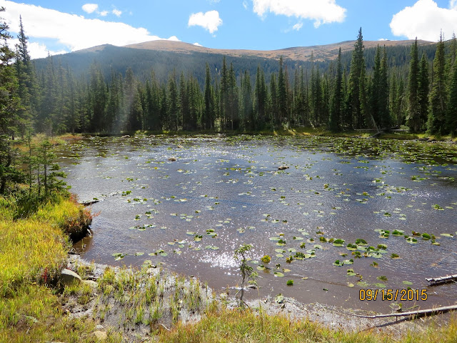
Unnamed Pond near Pear Lake

Track

Overall Track Statistics for track RMNP - Pear Lake
 Length 13.608 miles
 Start Elevation - 8640.68 feet
 Maximum Elevation - 10572.74 feet
 Minimum Elevation - 8091.67 feet
 Date of Hike - Sep 15, 2015
 Start Time - 08:37 AM
 End Time - 02:52 PM
 Total Duration -     6:15 hours:min
 Total Ascent - 3222.54 feet
 Total Descent - 3771.56 feet
 Net Ascent - -549.02 feet
 Maximum Grade - 18.54%
 Average Speed -  2.18 mph
 Maximum Ascent over Mile - 648.33 feet
 Maximum Speed over Mile -  2.95 mph
 Maximum Gain over Mile (%) - 11.85%


Profile